We've had about 4.5 feet of snow in the past month. No reason to stay inside, however. The roads are plowed.
I don't think I've ever seen anything quite like this in Connecticut!
The snow banks on the corners (in this case, a traffic island) are so tall you can't see over them when driving.
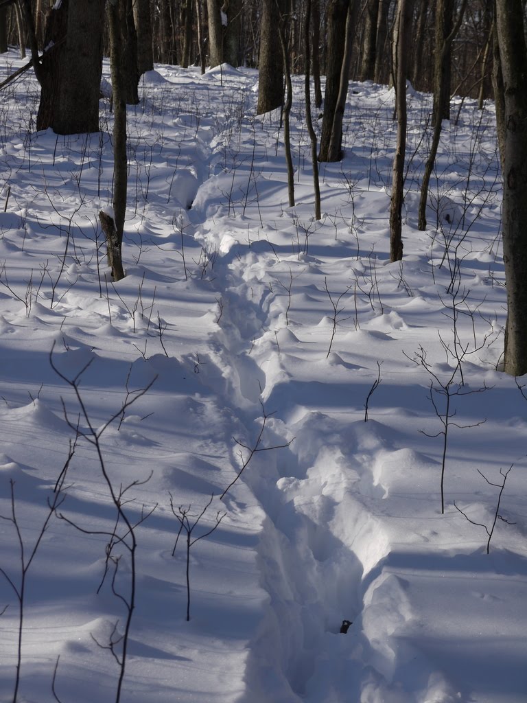
Here's the Shelton Lakes Rec Path where it crosses Wesley Drive. Nope, I didn't go on it. Need some really big snowshoes for that depth, and mine are on the small side.
Lots of roofs have been collapsing and leaking, so people are doing their best to clear off the snow.
The Blue Trail off of Pumpkin Ground Road was well-worn by snowshoes this morning. Boots with spikes might work pretty well, but I had my light snowshoes on.
This old bridge has recently been replaced by the one I'm standing on. Good thing, I guess. The swampy area just across the bridge has turned into a deer yard, with tracks all over. In deep snow, deer will congregate in sheltered areas with food and cover.
Lots of animal sign out there. Here are some droppings next to a tunnel.
The deer pawed away the snow and oak leaves looking for acorns...
...and were successfull. Here are some bits of acorn shell up on the snow.
I turned on the red trail, which was not as packed as the blue trail. In fact, it was mostly deer tracks. Definitely needs the snowshoes there.
That's a whole lot of mouse tracks!
I turned off the Red Trail onto this deer trail in an effort to find a geocache.
A pair of light snowshoes made easy work of the Rec Path, especially since someone had been in there with a snowmobile (illegal, but it happens). I parked at the Dog Park on Nells Rock Rd & Shelton Ave because that's the only lot that had been plowed.
I followed the newly constructed Rec Path behind Hope Lake.
It was beautiful, and I got hot using those snowshoes, even with the snow packed down. That's a good workout!
Here's the Indian Cave at the junction with the White Trail. The cave doesn't look like much head-on, but if you go inside the overhang, it's pretty spacious.
This rock appears to have teeth.
The nice thing about parking at the Dog Park is that Biscuit was overjoyed to finally get off the leash and run around in the fenced area with other dogs (both before and after our hike). It's a two-for-one spot if you have a dog!
It's come to my attention that an alarming number of my Connecticut friends are really miserable in the winter. Having grown up in Minnesota, where winters were much longer and more severe (I once took my dog for a walk when the wind chill was -72° just to see what it would feel like), I'm going to offer a few tips on how to make the most of winter.
1. Get a warmer coat. Seriously. Very few people in Connecticut have a proper winter coat. Teens are out waiting in the snow for the bus in hoodies -- hoodies!-- and adults are out in skimpy trendy pseudo-winter coats (like the ones pictured here), proving they are no smarter than their kids.
These are fine if you live in Alabama. Look at the temperature ratings for a coat before you buy it. I have a long down coat from Lands End rated for -35° to -15° that I just love. I am never cold in that coat. In fact, I get too hot while exercising, but it's great for standing around at the dog park or running errands. While you're at it, get some proper gloves and boots. If you're properly dressed, the winter air on your cheeks will feel crisp and invigorating, not cold.
2. Go do something outside every day. Otherwise you will get "cabin fever" and become depressed. I walk a couple miles a day all year long. It's actually more comfortable walking in the winter than in the summer, assuming you have a proper coat, because you don't get all sweaty and overheated. Take up winter sports like skiing or snowshoeing. This is what people in the North do. Otherwise they would shoot themselves.
3. Don't allow yourself to think about spring or summer or anyplace warm until March. That's right, you heard me. You will just make yourself miserable focusing on what you want instead of making the best of what you have. Go into a winter frame of mind - embrace the season! Focus on the good aspects of winter - hey, no bugs or poison ivy, and no need to take two showers every day only to be covered with sweat after 20 minutes. No pollen or mold. You don't have to mow or weed the garden. And the snow transforms the landscape in a rather magical way. Enjoy it while you can!
Laurel Lime Ridge is one of those unrefined parks where the "trails" are more like ATV paths or old roads, the markings look rather ad-hoc, and there are apparently no maps.
In spite of that, or maybe because of that, it's a neat park, and if you can find your way to the look out, you are rewarded with a view up the Housatonic River. The overlook here is directly opposite the river from Birchbank Mountain in Shelton.
Ice crystal formations in the paths were difficult to walk on in places. But pretty.
Along the top of the ridge there are a series of interesting rock formations, overhangs, and quarries. In the picture above you can see a thick gleaming-white seam of calcareous rock, which is unusual around these parts. This is rock with lots of calcite, as in calcium carbonate or lime. A ridge of lime. And a few mountain laurels. Which is presumably why they call it Laurel Lime Ridge. Not sure what they mined it for. But this is the same rock formation that was mined for tungsten, silver, and other metals that pops up in Trumbull, Monroe, and Shelton (see geology map - the formation is in orange). So it was probably some type of metal. The stone ruins in the photo above were near a small quarry and were probably related to the operations there.
The park is about 210 acres, and as far as I can tell it is owned by the Seymour Land Trust. If you're interested in exploring, we parked at the end of the cul-de-sac for Tibbets Road. And I was happy to have my gps with us (found a geocache while we were at it). The trails are all very wide and eroded, and it looks like there may be a lot of ATV traffic in there at times, but we were alone during our visit.
We decided to try the new "outer loop" hike at Birchbank, which is a combination of Birchbank Trail (white), the new blue-yellow connector, and the Paugussett Trail (blue). Two of our party (including the dog!) stepped right over this little Woodland Vole that was in the middle of the trail. It was still alive, but barely. It didn't look injured, but they have a life span of only three months, so maybe it was just old.
There are so many little mouse-like animals in Connecticut, it's hard to know what you're looking at. This one is clearly a rodent because of the two front incisors. Shrews look like mice but are unrelated and have teeth more like a dog. So we get to choose from mice, moles, and voles. The short tail, little eyes, and lack of powerful digging arms (like a mole) make this one a vole.
Near the chimney are the remains of a buck that was killed by a hunter. Another hiker reported vultures feeding on it. The buck must have run far enough away after he was hit so the hunter couldn't find him. Hunting is illegal at Birchbank, but legal on abutting private properties. So this one has become food for the coyote, bobcat, fisher, ravens, vultures, and other forest animals.
Here's the new stretch of blue-yellow trail heading up to the overlook of the Housatonic River. The new part is 0.2 mile and not steep at all.
Previously, the only way to get up to the overlook was via a steep section of trail that has been blazed blue-yellow since the early 1990s, but was once the main Paugussett Trail. The trail was reportedly rerouted in anticipation of housing construction on Golden Hill which was going to block the route. At the last minute the route was saved, but the trail had already been rerouted. So a spur to the overlook was reblazed blue-yellow, and the trail north of that abandoned.
You never know what you're going to find along the trail. I've been on the white trail a zillion times, but just noticed this tacked to a tree for the first time.
"Build it and they will come." Sure enough, the Shelton Dog Park isn't even technically open yet, but lots of people are using it. Today there were seven cars and eight dogs when I pulled in.
Here you can see how there are two sides, one for small dogs and the other for large dogs (who looked like wanted to chase down the little ones today). You can also see how dog parks aren't just for dogs. They're for the dog owners, who you can see chatting in the background. Most popular ice-breaker: "What kind of dog is that?"
These two dogs ran around so frenetically they made us all laugh. They'll sleep good tonight!
The Shelton Dog Park is located at the corner of Nells Rock Road and Shelton Avenue.
Found this Marbled Salamander today at BirchbankMountain in Shelton while blowing leaves off of a new section of trail directly below the cascades of Upper White Hills Brook. The spot was very low and wet, and the soil is very sandy, perfect conditions for this kind of salamander. The salamander was about 4" long, which is about as big as they normally get. They breed in vernal pools, and I suspect the nearby "aquifer recharge ponds" on Aquarion land are where they are breeding.
I just love how this Housatonic River floodplain forest is home to plants and animals I tend not to see in other areas. I have said before that this open space is our most sensitive. In the same area where I found the salamander, we have tons of red trillium, Dutchman's breeches and Blue Cohosh blooming in the spring. And it was right in the path where ATVs used to ride. Fortunately, we are seeing the ATV traffic declining significantly now since a concerted effort was made to discourage riders from entering the park.
YVOLD GSV XZHXZWVH, FKKVI DSRGV SROOH YILLP HKORGH RM GDL. GSV HLFGS ULIP NZB YV WIB. UILN GSV HLFGS ULIP, TL MLIGS GL MVCG DSRGV YOZAV, GSVM HRCGVVM HGVKH NLIV ZMW OLLP OVUG YVSRMW Z GIZK WLLI RM ILXPH. (12-2012 - the trail was recently relocated 50 feet down the hill approaching the new structure, but the object in question was not).
The Shelton Dog Park is almost open! The fencing is complete except for the gates. The Park is located at the corner of Nells Rock Road and Shelton Ave. (Rt 108) behind the little white house there, which you can see in the photo above.
There are two sections, one for small dogs and one for large dogs. The part for large dogs is really large, as you can see in the photo above.
Girl Scout Troop 363 painted this trash container last year for the dog park and it was nice to finally set it out.
Here's a nice old oak in the middle of the park.
There is a mountain of road millings that needs to be screened and spread for parking. There will be parking not only for the dog park, but also for the Shelton Lakes Recreation Path that will be extended this fall.
A large chunk of "Transitory Open Space" lies behind Perry Hill School in Shelton, featuring several ponds and an Indian cave. The pond in the photo above is called Walnut Avenue Pond on the open space map. I saw a wood duck, snapping turtle, frogs, and fish in my brief visit there.
Here's a substantial Indian Cave located near the pond. The 57-acre property is listed as "Transitory" open space because it was purchased back in the mid-1990s for the eventual extension of Constitution Blvd North and other possible uses, including economic development.
Walnut Avenue Extension runs north-south through the property, although vehicles are blocked off with Jersey barriers.
This pond is located at the end of the drivable portion of Walnut Avenue Extension and is called "D'Onofrio Pond" on the open space map. It's located on private property, but can be seen from the open space.
Near the D'Onofrio Pond is some unexpected artwork, somehow color coordinated with the changing leaves.
There's really no easy access to the property, which is shown in orange on the map above. The adventurous might find their way onto the property via Perry Hill School (when school is closed) by walking behind the rear fields to the right and turning onto an ATV path there. The path takes a left across a small stream, and then you are on the Mas property. Walnut Ave Extension is another possibility. Nothing is marked, so a gps or a good sense of direction are necessary. Note on the map above that the white "roads" going through the orange open space have not been built.
I'm the Shelton Conservation Agent, sheltontrails.org webmistress, and a letterboxer & geocacher. These pursuits often take me out exploring in the field.