Friday, November 26, 2010

Birchbank Mountain Trek

We decided to try the new "outer loop" hike at Birchbank, which is a combination of Birchbank Trail (white), the new blue-yellow connector, and the Paugussett Trail (blue). Two of our party (including the dog!) stepped right over this little Woodland Vole that was in the middle of the trail. It was still alive, but barely. It didn't look injured, but they have a life span of only three months, so maybe it was just old.

There are so many little mouse-like animals in Connecticut, it's hard to know what you're looking at. This one is clearly a rodent because of the two front incisors. Shrews look like mice but are unrelated and have teeth more like a dog. So we get to choose from mice, moles, and voles. The short tail, little eyes, and lack of powerful digging arms (like a mole) make this one a vole.

Near the chimney are the remains of a buck that was killed by a hunter. Another hiker reported vultures feeding on it. The buck must have run far enough away after he was hit so the hunter couldn't find him. Hunting is illegal at Birchbank, but legal on abutting private properties. So this one has become food for the coyote, bobcat, fisher, ravens, vultures, and other forest animals.


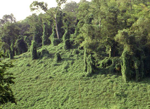
Here's the new stretch of blue-yellow trail heading up to the overlook of the Housatonic River. The new part is 0.2 mile and not steep at all.

Previously, the only way to get up to the overlook was via a steep section of trail that has been blazed blue-yellow since the early 1990s, but was once the main Paugussett Trail. The trail was reportedly rerouted in anticipation of housing construction on Golden Hill which was going to block the route. At the last minute the route was saved, but the trail had already been rerouted. So a spur to the overlook was reblazed blue-yellow, and the trail north of that abandoned.

You never know what you're going to find along the trail. I've been on the white trail a zillion times, but just noticed this tacked to a tree for the first time.

Sunday, November 21, 2010

Shelton Dog Park

"Build it and they will come." Sure enough, the Shelton Dog Park isn't even technically open yet, but lots of people are using it. Today there were seven cars and eight dogs when I pulled in.

Here you can see how there are two sides, one for small dogs and the other for large dogs (who looked like wanted to chase down the little ones today). You can also see how dog parks aren't just for dogs. They're for the dog owners, who you can see chatting in the background. Most popular ice-breaker: "What kind of dog is that?"

These two dogs ran around so frenetically they made us all laugh. They'll sleep good tonight!

The Shelton Dog Park is located at the corner of Nells Rock Road and Shelton Avenue.

Saturday, November 20, 2010

Marbled Salamander at Birchbank

Found this Marbled Salamander today at Birchbank Mountain in Shelton while blowing leaves off of a new section of trail directly below the cascades of Upper White Hills Brook. The spot was very low and wet, and the soil is very sandy, perfect conditions for this kind of salamander. The salamander was about 4" long, which is about as big as they normally get. They breed in vernal pools, and I suspect the nearby "aquifer recharge ponds" on Aquarion land are where they are breeding.

I just love how this Housatonic River floodplain forest is home to plants and animals I tend not to see in other areas. I have said before that this open space is our most sensitive. In the same area where I found the salamander, we have tons of red trillium, Dutchman's breeches and Blue Cohosh blooming in the spring. And it was right in the path where ATVs used to ride. Fortunately, we are seeing the ATV traffic declining significantly now since a concerted effort was made to discourage riders from entering the park.

YVOLD GSV XZHXZWVH, FKKVI DSRGV SROOH YILLP HKORGH RM GDL. GSV HLFGS ULIP NZB YV WIB. UILN GSV HLFGS ULIP, TL MLIGS GL MVCG DSRGV YOZAV, GSVM HRCGVVM HGVKH NLIV ZMW OLLP OVUG YVSRMW Z GIZK WLLI RM ILXPH. (12-2012 - the trail was recently relocated 50 feet down the hill approaching the new structure, but the object in question was not).

Saturday, October 30, 2010

Shelton Dog Park

The Shelton Dog Park is almost open! The fencing is complete except for the gates. The Park is located at the corner of Nells Rock Road and Shelton Ave. (Rt 108) behind the little white house there, which you can see in the photo above.

There are two sections, one for small dogs and one for large dogs. The part for large dogs is really large, as you can see in the photo above.


Girl Scout Troop 363 painted this trash container last year for the dog park and it was nice to finally set it out.


Here's a nice old oak in the middle of the park.

There is a mountain of road millings that needs to be screened and spread for parking. There will be parking not only for the dog park, but also for the Shelton Lakes Recreation Path that will be extended this fall.

Wednesday, October 27, 2010

The Mas Property Behind Perry Hill School, Shelton

A large chunk of "Transitory Open Space" lies behind Perry Hill School in Shelton, featuring several ponds and an Indian cave. The pond in the photo above is called Walnut Avenue Pond on the open space map. I saw a wood duck, snapping turtle, frogs, and fish in my brief visit there.

Here's a substantial Indian Cave located near the pond. The 57-acre property is listed as "Transitory" open space because it was purchased back in the mid-1990s for the eventual extension of Constitution Blvd North and other possible uses, including economic development.

Walnut Avenue Extension runs north-south through the property, although vehicles are blocked off with Jersey barriers.

This pond is located at the end of the drivable portion of Walnut Avenue Extension and is called "D'Onofrio Pond" on the open space map. It's located on private property, but can be seen from the open space.

Near the D'Onofrio Pond is some unexpected artwork, somehow color coordinated with the changing leaves.

There's really no easy access to the property, which is shown in orange on the map above. The adventurous might find their way onto the property via Perry Hill School (when school is closed) by walking behind the rear fields to the right and turning onto an ATV path there. The path takes a left across a small stream, and then you are on the Mas property. Walnut Ave Extension is another possibility. Nothing is marked, so a gps or a good sense of direction are necessary. Note on the map above that the white "roads" going through the orange open space have not been built.

Friday, October 22, 2010

Salmon River Trail, Colchester

The CT Blue-Blazed Salmon River Trail is located in Day Pond State Park, right across the street from Salmon River State Forest. I was looking forward to seeing the Comstock Covered Bridge, located at the trailhead, but turns out it's been dismantled for restoration. I wasn't sure how to get myself across the river with no bridge, but I got back in my car and managed to find a spot to park at the end of Bridge Street next to the bridge on the opposite side of the river.

The Salmon River was gorgeous.

The trail climbed pretty quickly, but the footing was good and it wasn't too steep. After a bit there's this nice lookout.

After walking along a ridge top for maybe two miles, and following the loop junction to the right, the trail came out at Day Pond, which was deserted. This is why I love hiking on Fridays, especially in Fall. I did finally see one person walking a dog at the pond and a man fishing, but that was it.

I was admiring the pond and its trickling little waterfall, when I was distracted by a large bird circling over the water nearby. Through the trees it looked like maybe an Osprey...


...and it suddenly plunged into the water to grab a fish.

Gotta love the October colors, especially that purplish red you get from the oaks.

Here's an attractive little centerpiece growing out of a rotting stump.

It's a seven mile hike if you park at the Comstock Bridge and do the entire "lollipop" loop, which I did. The trail was well-blazed, the footing pretty good, and there were ups and downs, but nothing really steep. A very enjoyable hike.

Funny trail sign. But effective.

A spur trail leads to a "campsite" overlooking a stunning series of cascades and falls.

Returning along the Salmon River after a great day looking for treasure.

Saturday, October 9, 2010

Mile-A-Minute Vine in Newtown

Here's some Mile-A-Minute (MAM) Vine, "Kudzu of the North", festering in Newtown, Connecticut, where it appears to be spreading. That's because of the berries. The vine can grow up to 6" a DAY. Bad. Very bad. Extremely bad. Climbing-up-the-trees-and-killing-them bad.


These bags are filled with MAM but there's lots more growing around them (with growth at 6" a day, what do you expect?). They need a small army of volunteers to pull this stuff before it spreads to the rest of the city, but instead they've had only a couple of people pulling it at the most, and they're losing the battle. Seriously?? The vine is spreading from the original location like spot fires in front of a wildfire. Too bad, since a small effort now would prevent HUGE efforts and damage later on. Just wait until homeowners have to start protecting their trees from being killed by the vine. And they'll wonder how it ever was allowed to spread like that.


Here's a video of the spot. Sorry about the quality, I messed up on the camera settings.


The leave are extremely triangular, and some of the leaves, including the final leaves before the berries, are joined to form a sort of cup that's fused around the stem (see the very first picture in this post).

All the stems have annoying barbs, similar to Tear-Thumb plants, which it is mostly likely to be confused with.

Everyone, please keep your eye out for this plant, and report it here. And if you live in Newtown, please contact the town Conservation Official Ann Astarita (see here), and offer to help pull the weed, because they can't do it alone, not at 6" a day, but they can't seem to find any volunteers. Otherwise, before you know it, we'll all be pulling it out of our yards to keep them from looking like THIS.

Sunday, October 3, 2010

Knotweed Update

It's been ten days since I injected most of this patch of Japanese Knotweed with Round-Up concentrate. The photo above was taken September 23, and the photo below was taken today...

It's autumn, of course, so all the leaves are yellowing, but the Knotweed has lost most of it's leaves, with the remaining leaves very yellow. Of course, the real question is, will it come back next year? Supposedly, using the injection system this time of year and low on the stalk, it will not come back.


The above picture was taken September 23, and the picture below was taken today (the remaining green blob in the center is actually an Autumn Olive shrub).

Wednesday, September 29, 2010

My Carrots and Their Ancestors

Growing in amongst our carrots this year was lots of Queen Anne's Lace. The leaves are very similar, so we left them, never quite sure which was which. When it was time to dig up the carrots, here's what we got. The ones on the left are the weed, which coincidentally happens to be the ancestor of the cultivated carrot (Queen's Anne's Lace is also called "Wild Carrot"). No wonder they look so similar!

Breaking open a root, the Queen Anne's Lace looked quite different from a normal carrot. It's not considered to be edible. The modern carrot is said to have a mutation whereby some really tough, woody tissue in the root (xylem) is missing, making them edible. I'll take their word for it.

When I picture Queen Anne's Lace, I picture flowers, not roots. The photo above is Queen Anne's Lace near Short Beach in Stratford. This flower grows up and down our highways. And when I picture carrots, flowers don't come to mind. I've never seen a carrot flower. Have you? So here's a link to an agricultural field of carrots in bloom. Look anything like the above photo?

Thursday, September 23, 2010

Japanese Knotweed - Death by Lethal Injection

Japanese Knotweed is infamous for invading, conquering, and taking over large swaths of ground, replacing the native vegetation with impenetrable stalks of "cane" that can easily grow twelve feet tall. Here's a patch measuring about 50 ft x 50 ft (and spreading), located near the trailhead for Nells Rock Trail, off Nells Rock Road in Shelton. According to Wikipedia, its roots can spread out up to 23 feet and go down up to 10 feet.

Once established, it is nearly impossible to eradicate. People have tried herbicide spray, digging it up, and covering it with sheets of plastic, with poor results. Instead, it is necessary to inject concentrated herbicide into the hollow stems, and they've even invented a tool for this: the JK Injection Tool, said to be 98% effective. This is the best time of year for that (the poison is drawn down into the roots), and so I spent a couple hours one morning attacking the patch at Nells Rock. I used a Sharpie to mark which canes had been injected. Only the canes that are injected will die. So each stem must be injected.

The Knotweed towered a good six feet over my head.

Here's a clue as to where the Knotweed came from. The plant was growing out of piles of gravel yard scrapings that had been dumped here long ago. The Knotweed had come along for the ride.

It's most efficient to attack small clumps before they become established, so I targeted this new patch along Hope Lake and the Rec Path. There were a total of only eight stems to inject. Hopefully those Knotweed plants are gone for good. We'll find out next year.

Here's another small patch growing along Hope Lake and Nells Rock Road. This patch is more of a problem since there are lots of small stems. The injector tool doesn't work on small stems -- it just splits them open. So I'll need another plan of attack for this clump.


Future projects: The Bluff Walk at Riverview Park is currently routed onto pavement at the basketball courts because there is a huge stand of Knotweed in the way (above). If I can kill off that Knotweed, we can get the trail off of the pavement. That's a big project, however, possibly for 2011. There is also Knotweed overrunning native wildflower areas at Birchbank Mountain, and some relatively new patches along the Blue Trail near Constitution Blvd North.